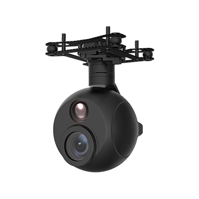
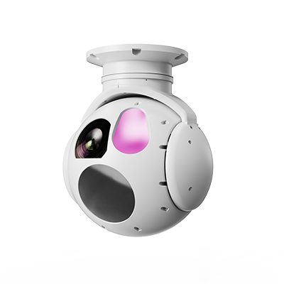
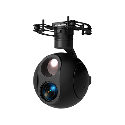
Centered on two high-performance optoelectronic turrets, the ZT055TA and ZT068FA from Taking Technology, this solution aims to build an intelligent, all-weather perception and reconnaissance system for unmanned surface vessels (USVs). Leveraging the turrets’ outstanding stabilized platforms and multi-spectral sensing capabilities, the system addresses the core requirements of surface and near-shore target search, identification, tracking and positioning for unmanned surface vessels navigating, monitoring, conducting law enforcement and emergency rescue missions.
Integrated with long-range laser ranging, round-the-clock imaging (day/night), automatic AI recognition, high-precision servo stabilization and target coordinate calculation functions, the two turrets greatly enhance the autonomous operation capability and intelligence acquisition efficiency of USVs under complex sea conditions. They serve as indispensable mobile sensing nodes for building application systems such as "smart maritime affairs", "smart fishery administration" and "smart border defense".
Border and Coastal Defense & Inshore Sea Patrol: USVs equipped with ZT055TA or ZT068FA can perform 24-hour continuous patrols in China’s maritime areas, especially around islands, reefs and sensitive sea zones. The uncooled infrared module (ZT055TA) or cooled infrared module (ZT068FA) can effectively detect small fast surface targets such as unregistered vessels and smuggling speedboats at night or under poor visibility. Automatic target recognition, locking and high-precision laser ranging (up to 6–10 km) enable precise positioning and continuous tracking of suspicious targets, with real-time video recording for evidence and data transmission back to the command center.
Port and Waterway Safety Monitoring: The ZT055TA is suitable for routine inspection within port areas or inland waterways. With its 20× high-definition EO zoom, it can clearly read vessel names and numbers from afar and observe navigation tracks to identify unauthorized sailing, illegal berthing or navigation obstructions. Supported by AI recognition, the system automatically detects floating objects in waterways such as broken fishing nets and large debris. Real-time coordinate transmission delivers accurate intelligence for timely response by administrative authorities.
Law Enforcement Evidence Collection and Emergency Response: During maritime fishery law enforcement, crackdowns on illegal sand mining or vessel oil spill incidents, USVs serve as forward mobile observation posts. The ZT068FA demonstrates prominent advantages. Its combination of 30× optical zoom and wide-angle lens balances wide-area search and detailed inspection, capturing high-definition video evidence from long distances, and is particularly suitable for recording details such as deck operations and illegal discharges. The cooled infrared system is sensitive to temperature differences over oil leakage zones and can quickly pinpoint pollution sources.
Special Climate / Nighttime Monitoring (Advantage Scenarios): In late-night, heavy fog or rainy conditions where conventional monitoring tools are limited, the low-light EO sensor (0.01 Lux) and infrared imaging capability of the ZT055TA sustain round-the-clock reconnaissance performance. Notably, the cooled infrared TI of the ZT068FA features superior thermal sensitivity, which can more effectively capture thermal radiation signatures of long-range, low-contrast targets under rough sea conditions, serving as core equipment to guarantee all-weather watchkeeping capability.
Maritime Search and Rescue & Target Positioning: In emergencies such as man-overboard incidents, USVs can rapidly arrive at the accident waters. The turret’s infrared mode (especially for the ZT068FA) scans the sea surface swiftly to detect heat signatures of persons in distress. Combined with precise laser ranging and coordinate calculation functions, the system quickly locates targets and sends exact coordinates to the command center and rescue vessels, saving precious time for rescue operations and enabling dynamic tracking and guidance of moving surface targets.
Case 1: USV for Intelligent Waterway Inspection and Violation Evidence Collection
A municipal waterway authority deployed 5 unmanned law-enforcement vessels equipped with the ZT055TA. Leveraging the dual-spectrum detection and AI automatic recognition functions (supporting identification of targets such as people and vessels), these vessels conduct 24-hour continuous scanning of waterways and adjacent shorelines during routine patrols. Its laser ranging function accurately measures distances to suspicious targets. Combined with GNSS data, the system calculates and reports latitude and longitude coordinates in real time. When the automatic recognition module detects vessels suspected of illegal sand mining, unauthorized pollutant discharge or illegal berthing within the waterway, operators can remotely control the turret for high-definition zooming and tracking video recording (H.264 video output). Footage of violations and precise coordinates are transmitted live to the command center to realize "remote + off-site" law enforcement. This cuts the manual inspection cycle that previously took several hours down to minutes, while forming a complete electronic evidence chain and greatly improving supervision efficiency.
Case 2: USV for Three-Dimensional Monitoring in Inshore Waters
For an inshore water monitoring project, 2 medium-sized unmanned monitoring vessels fitted with the ZT068FA perform large-area water patrols. The turret’s over-the-horizon 10 km laser ranging capability enables precise ranging and positioning of vessel activities in distant waters. Featuring outstanding thermal sensitivity, its cooled infrared imager (3–5 μm operating waveband) can effectively detect floating debris on water, thermal anomalies from oil spills, or body heat signatures of persons overboard at night or in sea fog conditions, supplemented by visible-light imaging for identification. The integrated capability of "thermal imaging locking + visible-light identification + precise laser positioning" upgrades the USV into an all-weather, over-the-horizon mobile monitoring outpost, serving as one of the core sensing nodes for building the inshore three-dimensional monitoring network.